The Bonneville Flood

Those who have been to Salt Lake City have probably viewed, or even floated in, Great Salt Lake. The lake is about 1/5th the size of Lake Ontario and is very salty. There are no out flowing rivers, and evaporation has decreased the average water level. Until a change occurs to bring a wetter climate, the lake will continue to shrink.

Now if you’d been here 17,000 years ago you would have seen a lake as big as Lake Superior, which flowed north through Zenda, Idaho, where for many years it ran over a dam of gravel. When the gravel soil dam eroded suddenly, the lake poured out in a tremendous flood. Over time the river cut back upstream to Red Rock Gap where the flow of water slowed while it eroded the limestone rock of the gap.

19-14 [800x600]
Rocks from flood are stranded at Massacre Rocks Park

The flood was one of the greatest floods of the continent. Water equal to the contents of Lake Ontario was suddenly let loose and with a crest over 100 metres, it surged down the narrow valley with three times the flow of the Amazon River. It probably took only a few weeks to drop the lake level 100 metres or more.

The rush of the water scrubbed the cliffs bare of soil. It peeled the black basalt rock off the cliff sides and from the bottom of the waterway. These huge blocks of rock tumbled and crashed into each other creating small pieces which became smoother and rounder the farther they rolled.
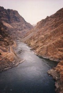
Rushing waters deepened old valleys.

Where the route was narrow, the water with its load of sand and rocks, cut it deeper and created great waterfalls that plunged over the cliffs and bored massive plunge pools at their bases.

Where the valley was wide the water spread out and slowed leaving sand settling into great ripples, similar to the ripples at the beach, only 50 metres or higher.  Many of the rounded rocks were left to litter the valley bottoms and they so much resembled a field of melons that one place is called Melon Valley.
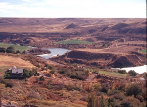
Springs gush from cliffs while melons litter the valley floor.

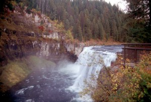
The flood turned some areas into scablands, but it did leave some attractive legacies. Twin Falls drops 55 metres and just downstream the beautiful cascading Shoshone Falls, falling 64 metres. The only problem is the destruction of the waterfalls by taking away the water to create electrical power production and for irrigation. Try to see them in their glory on a wet spring when the water is really moving.
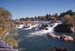
The flood created many beautiful waterfalls.

At Massacre Rocks St. Park you will see large hunks of basalt moved here by the massive surge of water. Down stream at The Twin Falls City, the Perrine Bridge vaults across the Snake River Canyon. There is a viewing platform at the ends of the bridge. It’s a good place to visualize the frothing water removing dark colour basalt from the cliffs and also deepening the gorge. There used to be springs from the cliff bottom, but that was before they started irrigating 300,000 acres of desert to create farms.

West of Twin Falls is the Hagerman Valley, and Thousand Springs, where it is often
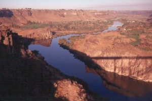
Shadow of the Perrine Bridge.

possible to see hundreds of small springs bursting from the cliff walls and making small waterfalls into the canyon. What is perhaps interesting about these springs is that their water has flowed 250 kilometres under a thick layer of lava. This water is supposed to be the water from the Big Lost River and the Little Lost River which vanished under the lava on the north side of the Snake River Plain. Again, in the summer, irrigation may have caused the springs to dry up.

Bruneau Dunes State Park has small lakes backdropped by dunes up to 140 metres high. It is thought that much of the sand to create these dunes came during the flood.


To read more about these areas see ‘The Lure of Pine and Sage’ one of the Touring North America scenic guide books. Visit www.stonesstravelguides.com
L’Anse aux Meadows National Historic Park

Christopher Columbus is credited for discovering North America when he came here in 1492, but he certainly wasn’t the man who discovered it. As I learned in public school,

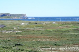
Isolated Coastline
Isolated Coastline

around the year 1000, Leif Eriksson, son of the adventurer Erik the Red, sailed west. He was probably not the first to make this trip, but he is recorded as finding a land where nice grapes hung thickly on vines. The name Vine Land stuck.

Viking Norsemen arrived on a lonely outpost in the northern part of Newfoundland where they established a small settlement. Pat Sutherland with the Canadian Museum of Civilization, has done extensive research that seems to show the Vikings also left artefacts on Nunavut, Baffin Island, and Labrador.

Sod Homes
Sod Homes

They may also have visited south to Nova Scotia and surrounding areas. Although the climate was warmer 1000 years ago, it may not have been warm enough farther north to have produced the vines of grapes that caused Leif Eriksson to name the land Vine Land. These likely were found to the south.

The L’Anse aux Meadows National Historic Park is worth the long drive to

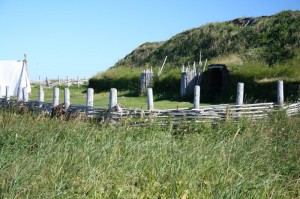
Layers of sod create the walls

get there. On Newfoundland’s west coast you head north past Gros Morne National Park almost to the very tip of a lonely peninsula. Route 430 follows the seacoast with spectacular views across to mainland Labrador. At Eddies Cove it strikes inland across the peninsula to Saint Anthony. Although you turn north before reaching this fishing village dating back to the 1500’s, you should take time to visit this town which is a favourite place for whale watching.

Lonely garden along the road.

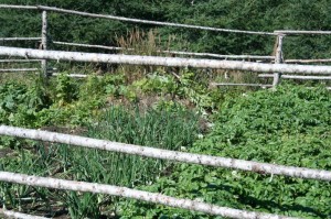
The highway winds through barren rock sparsely covered with vegetation in places. In other places there are steep hills and lots of short evergreen trees. It’s interesting to see small gardens along the road, tended by people from town who have managed to find a pocket of soil large enough, and fertile enough to grow their vegetables.

Inside the sod hut.
Inside the sod hut.

As you walk into the L’Anse aux Meadows NHS you are struck by the emptiness of the area. Yet in the midst of wind swept isolation you see several large humps that upon closer inspection reveal themselves as structures built with sod walls with roofs layered with sod and grass. You enter to find a fire pit in the centre to remove the chill. Smoke escaped through the roof vents and probably caused a lot of stinging eyes and smoky lungs because smoke doesn’t always obey any rules, and might not all head for the upper vents.

Metal Tools
Metal Tools

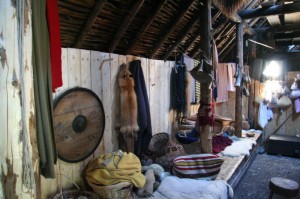
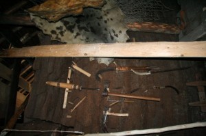
On the walls are hung furs, and nets, and finely woven garments. It’s obvious this settlement has been built for the long stay. Wooden bunks are built along the walls and covered with comfortable furs to sleep upon. Hung on pegs in the walls you will see an assortment of axes, hooks, and other devices made from iron. There is even an old loom for making cloth.

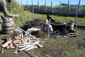
Outside you will likely find a couple of re-enactor Norsemen working in a fire pit. Here they will place dry wood, and cover it with

Pit where iron is smelted.

bog iron, close it over and let it burn to smelt the iron from the raw bog iron. This location is the first example of smelting in North America, and far ahead of the Europeans that Columbus brought to the shores of southern North America. The production of iron meant they could make nails, and other simple tools.

Travelling anywhere in Newfoundland will take you through miles of forests, lakes and mountain scenery. It’s extra special when you have the opportunity to visit a place like L’Anse aux Meadows.

Happy RVing !

For more than four decades James Stoness has travelled the roads of North America, photographing and writing about what he has seen. His travel articles and beautiful pictures have been published in several magazines and newspapers. He is also the author of five western novels.  Visit his website at:  www.stonesstravelguides.com
On the Trail of the Giant Calderas

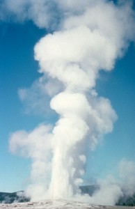
Old Faithful Geyser
Old Faithful Geyser

Before it was something for humans to worry about , the North American Continent was wracked by huge volcanic eruptions the like of which humans have never seen. Those who travel to Yellowstone National Park observe the eroded remnants of these calamitous explosions which form the Yellowstone Caldera.

Yellowstone NP is the youngest of a string of calderas stretching from Oregon to Wyoming. One theory is that about 17 million years ago a meteor plunged through the earth’s crust into the underlying mantle which released the pressure below and a massive eruption followed.

The question is then, how come there is a caldera at

Yellowstone Cliffs
Yellowstone Cliffs

Yellowstone in Wyoming, when the hotspot was created in Oregon? Well,the answer is a bit confusing. The hotspot never moved. It’s still where it was created 17 million years ago. Instead Yellowstone NP is now sitting over the hotspot because the crust of Central North America is slipping southwest at about 2” each year, so 17 million years later, Wyoming is sitting where the old Oregon would have been.

Fossil Stump in Yellowstone NP

There are other theories, but I like this one. Now, on the crustal journey southwest as the crust moved across the hotspot the eruptions would cease for a time, and then pop up sort of like a cutting torch punching through steel, and then there would be another huge eruption and another caldera. There is a chain of the calderas running northeast across the country from Oregon to Wyoming.

These eruptions are so severe because the eruption releases rhyolite magma. Rhyolite

Water Fall Near Yellowstone NP

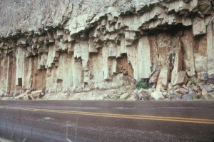
magma has the ability to absorb huge quantities of water which remain absorbed so long as the pressure is kept on the top. Release the pressure by cutting through the crust and the steam expands in a massive explosion carrying magma and anything else in the way to the surface. Great clouds of hot rock move across the landscape in great pyroclastic flows that weld together forming tremendous cliffs of soft rock.

Large Cinder Cone
Large Cinder Cone

When you travel in Yellowstone NP some of the great cliffs are the result of these cooling pyroclastic flows. If you try to follow the trail of the calderas you will find it difficult to see much. Erosion has done its work and many of the old calderas are flattened. Highways pass right through the Rexburg Caldera but you’d not know it was there.

Your drive is made interesting by secondary eruptions that have occurred across these plains and have spewed out a very liquid black basalt lava which has created

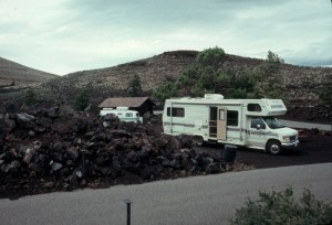
Lava Beds of Craters of the Moon NM

very interesting lava beds, and nearby there may be cinder cones from which the lava often flowed. Craters of the Moon National Monument has preserved many of these lava flows and has good examples of cinder cones.

Whether at Yellowstone National Park, or areas farther west you will find interesting scenery, and great camping. Take some time and explore.

You can find more information and maps showing some of these features in my scenic tours book, “The Lure of Pine and Sage”, which is available as a download from my website, www.stonesstravelguides.com