Along the Mackenzie River

Do you have the urge to visit a remote area where human presence is a rarity? I suggest taking a drive to the North West Territories and visit the Mackenzie River?

Camping by the Mackenzie RIver
Camping by the Mackenzie River

The Mackenzie River is the longest river system in North America that flows north to the Arctic Ocean. It was named after the explorer Alexander Mackenzie. The natives call it Deh Cho.

Mackenzie arrived at Lake Athabasca to replace Peter Pond, one of the partners of the North West Company. The North West Company was an immense fur trading company based out of Montreal. Peter Pond was from below the border and had already drawn and sent a map of the area the US government, an event that made him a great concern to the authorities in Canada.

Across the Wide Mackenzie

He was suspected of murder, although not proven, and after a second death where he might have been involved, it meant it was time for him to go. He would be replaced by a kinder and gentler person, young Alexander Mackenzie.

In 1789, working on the rumour that a great river flowed northwest, he headed an expedition to go down the river and to find the Pacific Ocean at the end. In doing so he would have discovered the North West Passage, a short cut to the Pacific Ocean that so far had eluded all searches.

Mackenzie headed down the great river but it wasn’t too many days before he realized it was heading north, and would never hit the Pacific Ocean. He named the water, the River of Disappointment. His progress along the river was fantastic taking only a couple of weeks to reach the mouth of the river. The return trip was hard, all uphill and battling the current yet he returned to the beginning point of his trip in only 102 days after having paddled over 4800 kilometres.

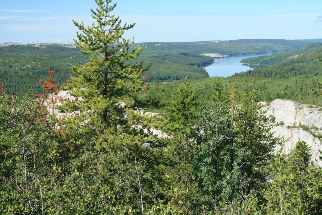
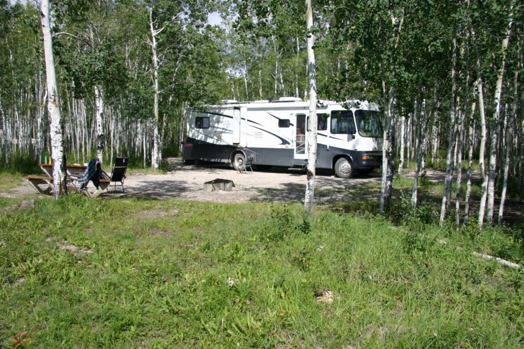
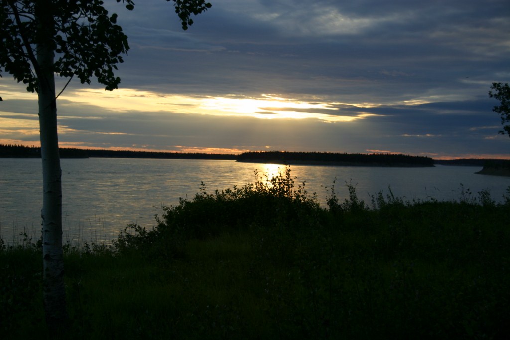
If you travel to Yellowknife, North America’s diamond capital, you will cross the Mackenzie River on a ferry, although a bridge is nearly completed. There is an excellent campground on the east side. It’s quiet, and the broad Mackenzie River whispers and gurgles as it tussles and pulls at the embankment. What a place this must have been before people arrived! This is likely the best place to stop and feel the emptiness of the river. It has a haunting whisper that begs you to follow it.

Evening on the Mackenzie

Farther north on the Mackenzie Highway you can turn off for a drive into Ft. Simpson which is on the banks of the river. A winter ice road runs north many miles but eventually comes to an area where the river crosses the Arctic Circle and is all alone with the wilderness for a long, long ways.

The next road crossing of the river is 57 kilometres east of Fort McPherson on the Dempster Highway at Tsiigehtchic, and a few thousand kilometres north of Ft. Simpson.

The River Crossing
The River Crossing

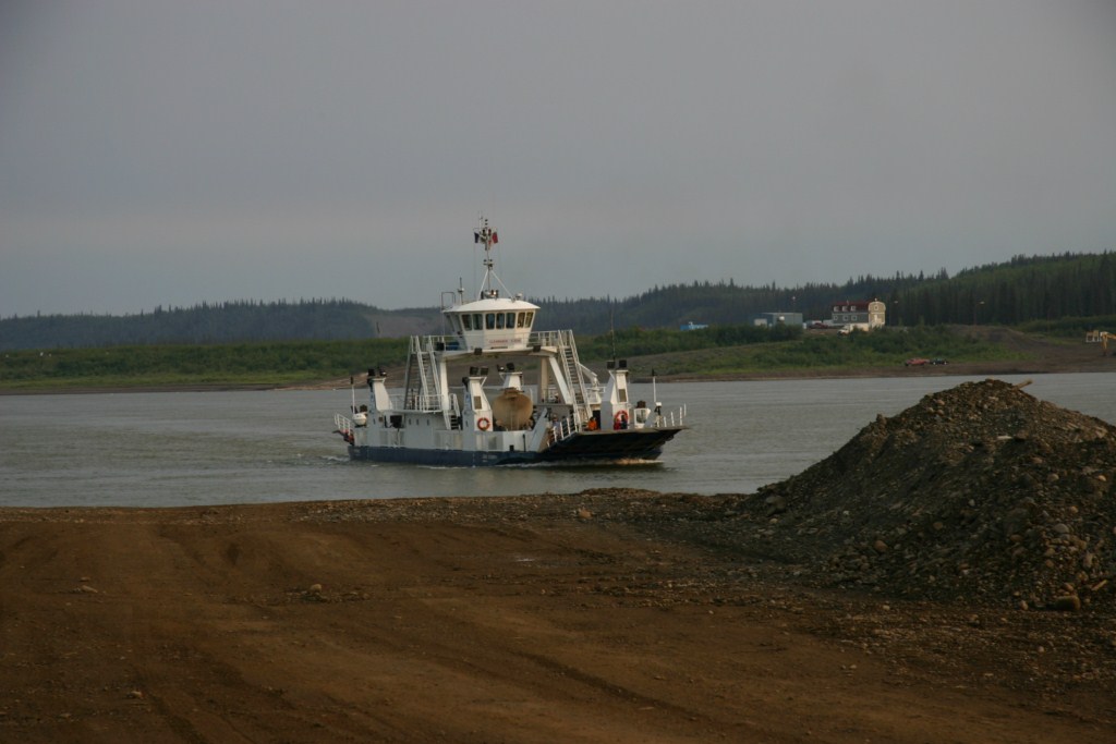
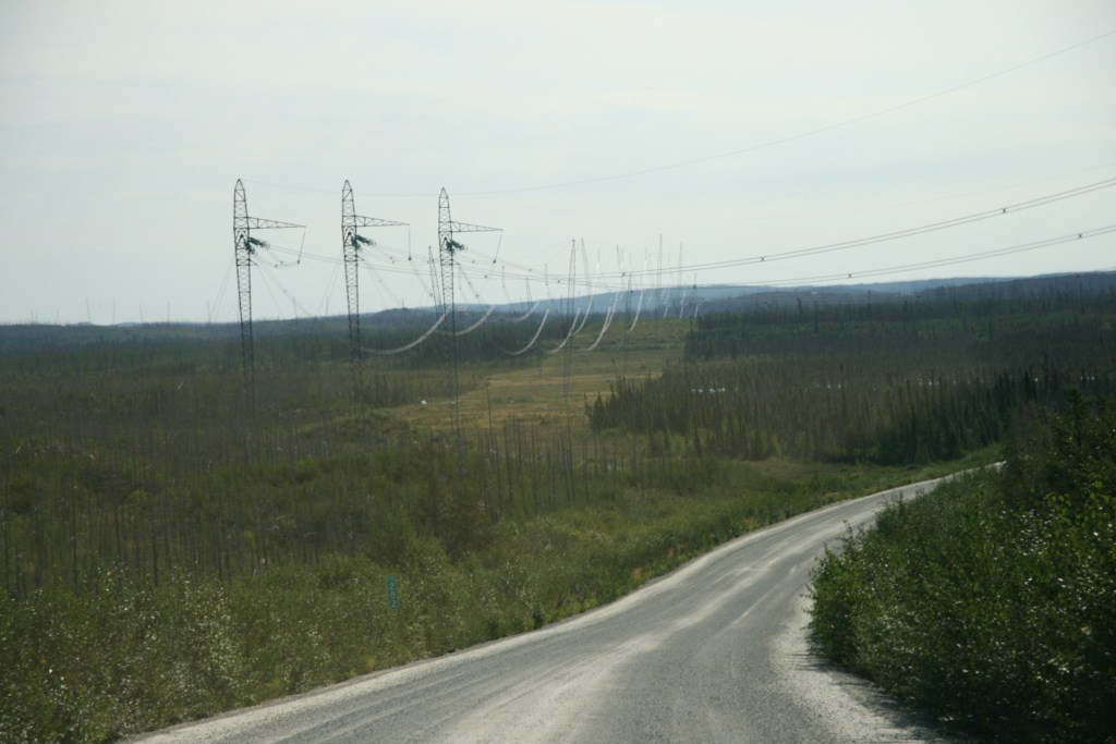
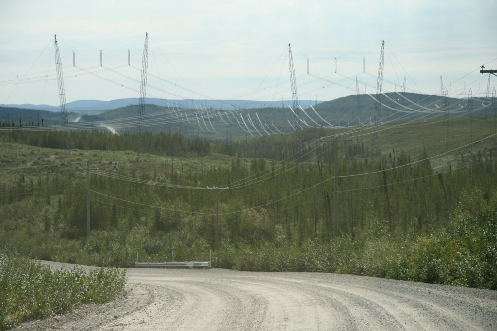
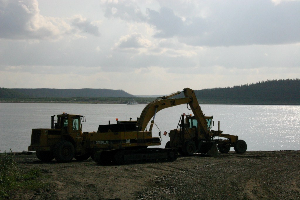
This is a ferry crossing and the approach to the ferry is sometimes muddy, but heavy machinery is nearby to pull you through. This is a dream drive but some people wouldn’t like 756 kilometres of gravel, mostly through empty country. Yet, the scenery is matchless, the road winding up and down and back and forth brings a new view at every turn.

So, if you are feeling adventurous, load up

When You Need a Little Help

the RV and head northwest. It can’t be beat!


For more than four decades James Stoness has travelled the roads of North America, photographing and writing about what he has seen. His travel articles and beautiful pictures have been published in several magazines and newspapers. He is also the author of five western novels.  Visit his website at:  www.stonesstravelguides.com


All Aboard the Orford Express

The City of Sherbrooke is located in the beautiful hill country in the Eastern Townships of Quebec. The area is well known for its great scenic driving especially during summer and autumn. This region has attracted tourists for these reasons and for one other very special reason

Fountain Jets

Sherbrooke is the home of the tourist train, the Orford Express. If you are looking for somewhere to go for a relaxing trip with fine scenery, and somewhere where you are pampered with great service and outstanding food, you should investigate the Orford Express and enjoy a trip from Sherbrooke through Magog to Eastman and back.

Orford Express Engines
Diesels ready to for the tour

Picture yourself looking from the large observation windows as you slowly move along the ribbon of steel. On one side is sparkling blue water and on the other side you are hemmed in by a rising hill cloaked in evergreens, punctuated by the appearance of large sections of exposed rock stepping roughly upward. Higher up the maple trees are just beginning to show the effects of Jack Frost and are very striking as huge white cumulus clouds float leisurely past.

Of course the open stretch of track backdropped by a small mountain flagrantly covered with fall colours is really nice too, especially since there are more of those fluffy white clouds floating across a really blue sky.

Excellent Meals
Sylvia awaits the arrival of the waiters.

If you are driving, a favourite picture shot is at the Eastman Bridge where you might be lucky enough to get a train reflected in the water.

All of the fun isn’t derived from the fine scenery. A large component of the trip’s enjoyment will come from a scrumptious meal served on your table. The crisp coloured tablecloth and matching napkins protruding from the wine glasses are just waiting for a guest. As the trip progresses the rising atmosphere of gaiety, laughter, and the clink of glasses is enhanced by the delicious aromas coming from the dishes that you are served.

When you arrive at the old train station in the train yard you move over to an old caboose, wine red and finished with beige on the top, to get your tickets. Right out in front the Orford Express will back up to receive its passengers; up to 200 can be seated.

Orford Express Cars
These attractive cars will take you on a great ride.

The cars are delightful to look at. Their stainless steel colour is trimmed with blue stripes and you will have lots of opportunity to observe them as you take a seat on one of the walkway benches. This is also a good place to observe the many people aimlessly walking along the broad walk talking and grabbing a few pictures before the trip.

Ticket Office
Tickets are available in the old caboose.

Reservations are required and you may have to select your main course days ahead of the trip so they will have it ready.

Parking, unfortunately, is not free, and since the 3 ½ hours trip is longer than the three hour limit at the station you must use a parking lot that is farther away through the pedestrian tunnel. Parking isn’t set up for large RVs and that’s a problem.

You will definitely find the trip relaxing. It’s a time to leave the world, and cell phones, behind and just enjoy yourself.

For more than four decades James Stoness has travelled the roads of North America, photographing and writing about what he has seen. His travel articles and beautiful pictures have been published in several magazines and newspapers. He is also the author of five western novels.  Visit his website at:  www.stonesstravelguides.com

Water Power is King in Quebec

The increase need for energy is a direct result of our fast growing modern lifestyle.

Quebec Power Project at Radisson

Before the use of fossil fuels to produce energy, man used the force of moving water. At first the moving water turned wheels that turned other things like saws, and mill wheels for grinding grain. Later the water turned generators that produced hydroelectric power.


James Bay country scenery

Hydro produced from rivers is a renewable resource. Except in unusual circumstances the river will continue to get its water from rain and melting snow, for years and years. One good thing about water is the fact that molecules of water entering a watershed will eventually pass through the system. The Province of Quebec is fortunate in having huge quantities of water in areas to the north where the population is low.

Overflow channel at La Grande 2


Outside of Quebec, it is not likely that many people know the magnitude of the James Bay project. Two rivers, the La Grande and the Eastmain Rivers, drain much of Northern Quebec westward into James Bay.

To harness the power of the water they built dams and eight generating plants on the La Grande. To get more water they diverted 90% of the Eastmain River’s flow into the La Grande system. All of this increased watershed almost doubled the flow of the La Grande River.

Power heading out on the wires

The electric power produced exceeded 10,000 MW. La Grande-2 dam and reservoir required the blasting of a huge spillway that steps down through the rock dropping the height of three Niagara Falls. Underground they carved out the world’s largest powerhouse. Entering this massive cavern is more like walking into a giant factory building. Everything is clean and tidy. The mighty generators seem to stretch endlessly into the distance. A close inspection of one of the generators shows the rotating of a huge shaft that connects the turbine to generator, and there is a slight tremor in the floor. This portion of the project can produce 5300 MW of electricity. The men on duty here are more like maintenance robots. The whole complex is run from a desk in Montreal.


Power Lines Through the Forest

The James Bay complex involves waters that reach back as far east as Labrador. This is an immense watershed covering the sub-Arctic region where winters start in October and may last until May. Although the region is sparsely settled it is the home territory of the Cree and the Inuit. Apparently they were missed out on the initial discussions and didn’t become aware of the project until Quebec Hydro started building a 700 km road to Radisson, near James Bay. This road was completed by 1974. In 1974 the Native Cree signed the Quebec Agreement to settle a score of land claims.


This is a well built highway, created to carry heavy generators and other parts to the project. Unfortunately, the first 300 kilometres were used by log trucks without any control on weights and they turned the flat road into a road with broken surface and bad bumps that require your RV to crawl at times. The north part of the road is good.

Thirteen large bridges cross a myriad of rivers, some with very attractive scenery, and some with very low flow because the river has been diverted to feed the main project of Phase I on the La Grande River. Eighteen thousand workers participated in the building of the dams, and high dikes that created the reservoirs. Hundreds of miles of hydro lines were built to take the energy south.

Another view of line corridor

When you look at a hydro line corridor, wide and bare of trees, you wonder how the men could have removed so many trees for such a long distance. That’s an incredible project, but 14 years later it was mostly completed.


The eight dams and power houses mean that same molecule of water from the upper end of the watershed passes through several generators and produces power over and over again. What a vast project! Move over Paul Bunyan!

Happy RVing !

This will be one of the tours in a Touring North America guide book about Eastern Canada.

For more than four decades James Stoness has travelled the roads of North America, photographing and writing about what he has seen. His travel articles and beautiful pictures have been published in several magazines and newspapers. He is also the author of five western novels.  Visit his website at:  www.stonesstravelguides.com