Gold in the Yukon

Gold in the Yukon! Those words echoed around the world and like a magnet they attracted people by the thousands. Of the approximately 100,000 who set off for the Yukon, only a puny 25,000 made it. Some of the dreamers were miners, others were people in other walks of life who suddenly saw a pot of riches at the end of a rainbow.
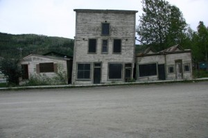
Historic Dawson City

Many of the potential miners, called Stampeders, took a ship up the west coast to Skagway, Alaska, and then hiked up the 50 kilometre Chilcoot Trail. This was not a route for the faint hearted. It consisted of a perilous climb over Chilcoot Pass to Bennett Lake.
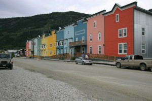
Colourfull downtown Dawson City

The Canadian government required miners to have about 1 tonne of supplies before they could enter Canada. Since the climb was too steep for horses, they had to pack the material to the top on their backs. Some 3000 horses and other pack animals died, leaving their bones to litter the canyon floor below. Stampeders left items they didn’t need along the trail realizing that they had purchased more than they could carry.

Frequently this trip was done in the winter and once they reached Bennett Lake, they spent the winter cutting timber to build boats and rafts to complete the next 500 miles on the Yukon River and reach Dawson City. Many died when their makeshift rafts and boats disintegrated in the turbulent rapids.
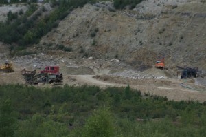
Gravel bank with gold

Some people travelled on a trip that took over a year going across the rugged country north of Edmonton. Yet, no matter how they travelled, there was no easy access to the Yukon in 1897.

Life wasn’t easy when they finally reached Dawson City either. Gold was not sitting around just waiting to be picked up. The easy sites had already been staked when these late comers got there. If a person were lucky he might find a job shoveling gravel for someone else, or in constructing buildings for the miners. Jobs were scarce and when their supplies ran out these new arrivals became hungry and depressed, and they returned to where they had come from in droves.
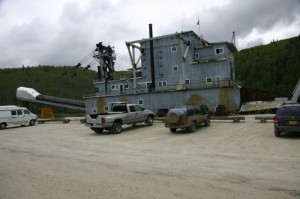
Dredge # 4
Dredge # 4

When you visit Dawson City you can drive to the gold fields. In fact you don’t have to go far before you begin to see the damage to the streams caused by the mining dredges when they took over.

Happy RVing

The Bonneville Flood

Those who have been to Salt Lake City have probably viewed, or even floated in, Great Salt Lake. The lake is about 1/5th the size of Lake Ontario and is very salty. There are no out flowing rivers, and evaporation has decreased the average water level. Until a change occurs to bring a wetter climate, the lake will continue to shrink.

Now if you’d been here 17,000 years ago you would have seen a lake as big as Lake Superior, which flowed north through Zenda, Idaho, where for many years it ran over a dam of gravel. When the gravel soil dam eroded suddenly, the lake poured out in a tremendous flood. Over time the river cut back upstream to Red Rock Gap where the flow of water slowed while it eroded the limestone rock of the gap.

19-14 [800x600]
Rocks from flood are stranded at Massacre Rocks Park

The flood was one of the greatest floods of the continent. Water equal to the contents of Lake Ontario was suddenly let loose and with a crest over 100 metres, it surged down the narrow valley with three times the flow of the Amazon River. It probably took only a few weeks to drop the lake level 100 metres or more.

The rush of the water scrubbed the cliffs bare of soil. It peeled the black basalt rock off the cliff sides and from the bottom of the waterway. These huge blocks of rock tumbled and crashed into each other creating small pieces which became smoother and rounder the farther they rolled.

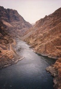
Rushing waters deepened old valleys.

Where the route was narrow, the water with its load of sand and rocks, cut it deeper and created great waterfalls that plunged over the cliffs and bored massive plunge pools at their bases.

Where the valley was wide the water spread out and slowed leaving sand settling into great ripples, similar to the ripples at the beach, only 50 metres or higher.  Many of the rounded rocks were left to litter the valley bottoms and they so much resembled a field of melons that one place is called Melon Valley.

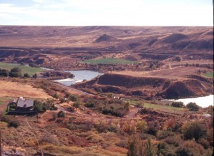
Springs gush from cliffs while melons litter the valley floor.

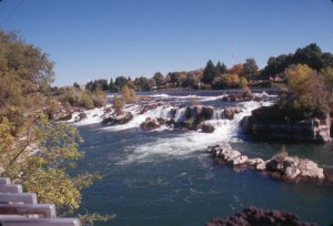
The flood turned some areas into scablands, but it did leave some attractive legacies. Twin Falls drops 55 metres and just downstream the beautiful cascading Shoshone Falls, falling 64 metres. The only problem is the destruction of the waterfalls by taking away the water to create electrical power production and for irrigation. Try to see them in their glory on a wet spring when the water is really moving.

The flood created many beautiful waterfalls.

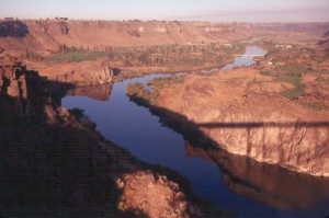
At Massacre Rocks St. Park you will see large hunks of basalt moved here by the massive surge of water. Down stream at The Twin Falls City, the Perrine Bridge vaults across the Snake River Canyon. There is a viewing platform at the ends of the bridge. It’s a good place to visualize the frothing water removing dark colour basalt from the cliffs and also deepening the gorge. There used to be springs from the cliff bottom, but that was before they started irrigating 300,000 acres of desert to create farms.

West of Twin Falls is the Hagerman Valley, and Thousand Springs, where it is often

Shadow of the Perrine Bridge.

possible to see hundreds of small springs bursting from the cliff walls and making small waterfalls into the canyon. What is perhaps interesting about these springs is that their water has flowed 250 kilometres under a thick layer of lava. This water is supposed to be the water from the Big Lost River and the Little Lost River which vanished under the lava on the north side of the Snake River Plain. Again, in the summer, irrigation may have caused the springs to dry up.

Bruneau Dunes State Park has small lakes backdropped by dunes up to 140 metres high. It is thought that much of the sand to create these dunes came during the flood.


To read more about these areas see ‘The Lure of Pine and Sage’ one of the Touring North America scenic guide books. Visit www.stonesstravelguides.com

The Scablands are Formed

Not so very long ago we were in the midst of an iceage. About 15,000 years back, Idaho and Washington saw a cycle of huge, instantaneous floods that wiped vast areas clean of vegetation, and even moved the rocks in the canyon walls.

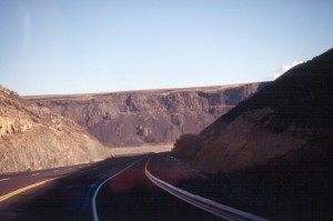
Driving into the Coulee

If you start the tour at Missoula, Montana, and head west on US-93 and then Mont-200 you would be driving through an area that was underwater from time to time. It’s a pretty drive to Clark Fork where it all started. A wedge of the Continental glacier exported from Canada pushed across the Clark Fork River filling the canyon and creating an ice dam that raised water up to 2,000 feet deep forming Glacial Lake Missoula. At Missoula you can look up at the hills and make out the erosional wave effects of the ancient lake.

The new lake would have held possibly 500 cubic miles of water, which is a lot. It would

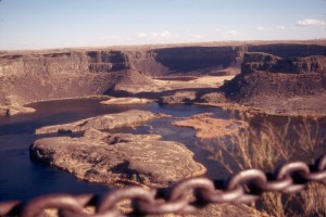
Distant edge of Dry Falls

have made a nice long recreational lake but it did have one problem. The dam leaked. After all it was made of ice, and water percolated through pores in the ice. Then at some instantaneous, calamitous moment, the ice lifted and the dam disintegrated, and a wall of water 2000 feet tall went roaring down the valley.

Much of the scenery from here westward illustrates the damage caused by the rampaging water. Soil was stripped from the land leaving bare surfaces exposed. Loose rock on the cliff walls was carried by the flood and transported to far off locations. It has been calculated that the flow of this river equalled that of the Amazon River for a short time. Once the flood exited the narrow confines of the mountains it spread out to 100 miles wide in a wave that swept everything ahead of it. This was the Spokane Flood, one of the west’s great geologic events that wasn’t volcanic.

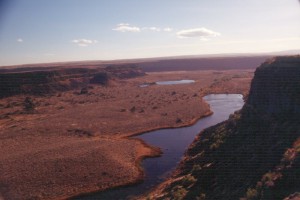
Much farther downstream we encounter the Columbia River which had carved a gorge known as the Grand Coulee. When the Spokane Flood washed through, the Grand Coulee became even more grand. There are several Coulees in the region and they were likely formed by water running across a resistant layer and cutting into softer underlying rock. As the rock was washed away the upper resistant layer broke and fell, and the new canyon got longer. The same process is occurring at Niagara Falls.

One of these former falls is Dry Falls, a falls that would have dwarfed anything we now know about. It had a lip three miles across, and was 400 feet high. So spectacular! The gorge is also dry, except for water leaking down through the rock from storage lakes above the old falls.

Picture this coulee brim full of fast moving water.

One hundred and fifteen miles southeast is Wallula Gap, caused by shoulders of the mountains coming almost together. The widely spread out water of the Spokane Flood had to funnel through the gap in a great surge. Water backed up into nearby canyons, and at Clarkston, on the Snake River, it backed up until it was over 600 feet deep.

One of the exciting things about this flood is that it repeated itself about 40 times, as ice dams formed, and disintegrated. All the floods were not to the same depth, and you can see wave action and beaches along the cliffs in places where the water ponded for a time.

If you drive near Camas Hot Springs, Montana, you will see a very unusual feature. You’ve seen ripple marks in the sand on a beach, but here you can see ripple marks that are 30 feet high, 200 feet apart and two miles long. These are immense ripple marks.

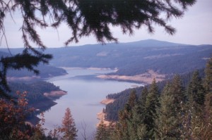
Good views along the way.

The scenery as you follow the Spokane Flood route varies from good to dull, but it’s worth the trip just to peer into the results of the historic floods.


This material was extracted from my Scenic Driving Tours Book, “The Lure of Pine and Sage”.

www.stonesstravelguides.com